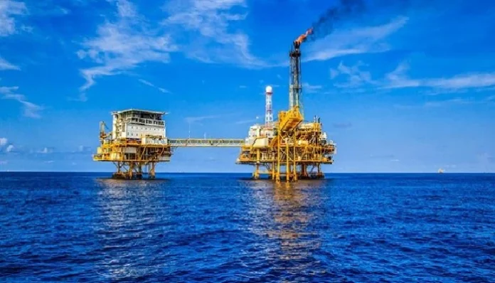
Even as societies are shifting towards renewable energy sources, the exploration of oil and gas remains a major economic driver. At the same time, this high-risk industry — both in terms of accident rate and the potential hazard to our planet — requires close monitoring to ensure full compliance with industry safety standards. And technology from a totally new market segment, the space industry, comes into play.
Since space tech has become commercialised, private companies significantly expanded their product lines to make sure the technologies meet factual contractor demand from a variety of different segments, including the oil and gas industry. Advances in private-made satellite cameras, such as https://dragonflyaerospace.com/satellite-cameras/, are particularly impressive because they allow tailoring space monitoring solutions to different needs, budgets, and, of course, industry segments. So, let’s see why satellite tech is an invaluable helper for the oil and gas industry.
Applications in the upstream oil and gas segment
Satellite applications in the oil and gas industry start straight at the upstream stage — often, even before because satellite tech can help identify promising exploration sites by analyzing geological data. Usually, this process requires human assistance from professional geologists or an exploration service that analyzes satellite imagery, studies surface pictures and makes educated predictions about the site’s potential for the industry.
To be clear, what is an oil and gas exploration service? It can be either a company that provides a full range of services, from collecting satellite imagery in designed areas of interest to submitting a final verdict on the potential of specific sites for the oil and gas industry, or it could be a technological platform that accomplishes some parts of the same process.
More specifically, how are satellite cameras used in the oil and gas industry? First, satellites take pictures and transmit them to Earth for analysis. In the case of identifying promising sites for the oil and gas industry, the data is sent to geologists who look for specific surface features, i.e., rock formations such as anticlines (upward folds in rock layers) because they often indicate the likelihood of underlying carbon material. For this analysis, multispectral and radar imaging is usually enough. However, it is also possible to use thermal imagery to detect any anomalies because sudden temperature rises in isolated areas can indicate active oil and gas deposits.
On-site: How are satellite cameras used in the oil and gas industry?

Once the sites are identified, further satellite uses in the oil and gas industry include:
- Environmental impact monitoring for any alarming changes in vegetation, surface, or nearby water bodies;
- Tracking production activities, which is an invaluable feature in extreme environments such as offshore rigs or desert installations, eliminating the need for the constant physical presence of supervisors.
However, satellite tech can only eliminate the need for physical presence if the imagery provides enough data in next-to-real-time mode. For this, one needs to understand — how does satellite transmission work? The basics are pretty simple — satellites collect data (take pictures), transmit them to ground stations for analysis, and receive new commands from the ground — for example, when a repositioning to a new area of interest is necessary.
Today, businesses in the oil and gas industry do not need to build an entire ground station of their own, which is essentially a huge satellite dish antenna with a powerful computer. Now, businesses, including those in the oil and gas industry, can either lease necessary ground station equipment from third-party providers or rely on cloud-based ground stations.
Depending on the amount of supplied data and the provider, industry plans can vary — but they are usually worth it because satellite applications in the oil and gas industry aren’t limited to site identification and monitoring — logistics and transpositions can leverage the same tech, too.
Satellite imagery in oil and gas transportation
Besides identifying and surveying industry exploration sites, satellite technology is of great help in monitoring pipelines or optimizing shipping routes — another tricky area that needs quality supervision. In the context of transportation, what are the applications of remote sensing in oil and gas exploration? Here are just some perks for the industry:
- Monitoring pipelines for leaks: advanced satellite sensors can detect temperature variations or unusual pressure drops, which are common signs of leakage.
- Tracking oil and gas tankers: tracking oil and gas tankers with ground-based tech could be very challenging, especially in international waters. Relying on satellite tech offers a viable solution for the oil and gas industry.
- Optimizing routes: satellite GPS systems are highly effective in optimizing shipping routes, reducing delivery times, and even saving fuel.
Those are only some currently available satellite applications for the oil and gas industry, but as technologies develop, the range of applications is expected to grow. Even now, there are considerable advances in using AI for data analysis or sending priority notifications from satellites, for example, in case of an emergency. So, space tech will keep reshaping the oil and gas industry for decades to come.
Is this article helpful? Keep reading our blog for more.


